Thanks to Cathy for this month’s theme: what are you most proud of?
Most people probably won’t know that I’m actually Dr Kate. My proudest achievement is that I carried out five years of research during my 20s and early 30s and was awarded a PhD in Landscape Ecology in 2002.
One of my (many) reasons for doing the PhD was to prove to myself (and others) that fat women aren’t stupid and lazy, a message that I had received all of my life. I knew I wasn’t stupid and lazy, but I wanted to demonstrate to the world that I was more than how I looked and that judging people by appearance is generally a ridiculous thing to do.
I always loved studying geography. It was my favourite subject at school and I went off to university in 1990 and did a physical geography degree. I loved my time at university, but I was having too much fun to really put the time in to studying, and I scraped by with a 2:1. I wanted to go on and do more, but it wasn’t to be; so between 1994 and 1996 I worked and spent some time volunteering for a conservation charity to enhance my skills.
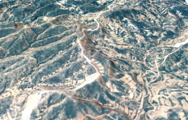
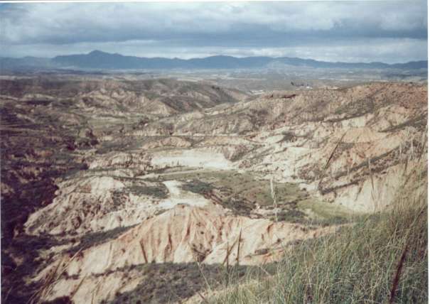
In August 1996 I was offered a funded PhD jointly between Liverpool University and Chester College (now Chester University). The funding was provided to study in the semi-desert Almeria Province in southern Spain looking at the landscapes of badlands and their vegetation. I was to be provided with remotely sensed data of the area by the Natural Environment Research Council who had undertaken flights over the site in early 1996.
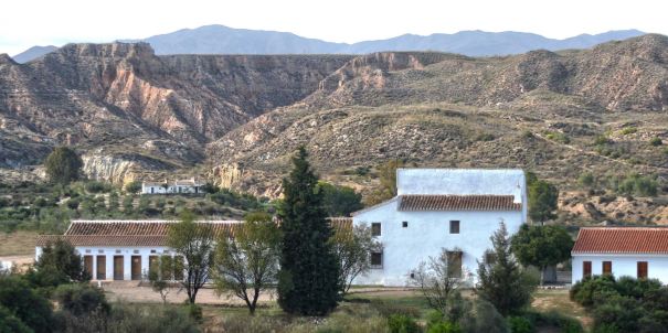
Within a week of moving to Chester, I found myself in a small field study centre called Urra in the middle of nowhere in the wilds of southern Spain at a conference! It was all very, very intimidating, all these academics, mostly middle aged white men and there I was a small, chubby 24 year old daring to think I could join their ranks.
I spent five field seasons out at Urra where I “ground truthed” the remotely sensed data that had not yet turned up. This meant that I went out to the sites I was studying and recorded plant and soil data in 5m square quadrats. What I was aiming to do with this information was to use it to help train the software I was using to recognise different plant communities by analysing the data.
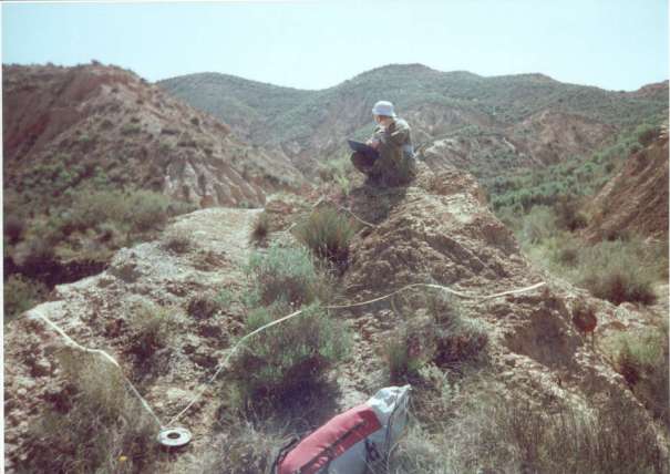
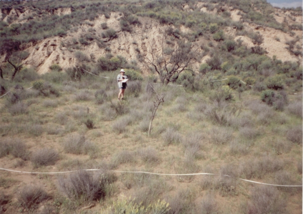
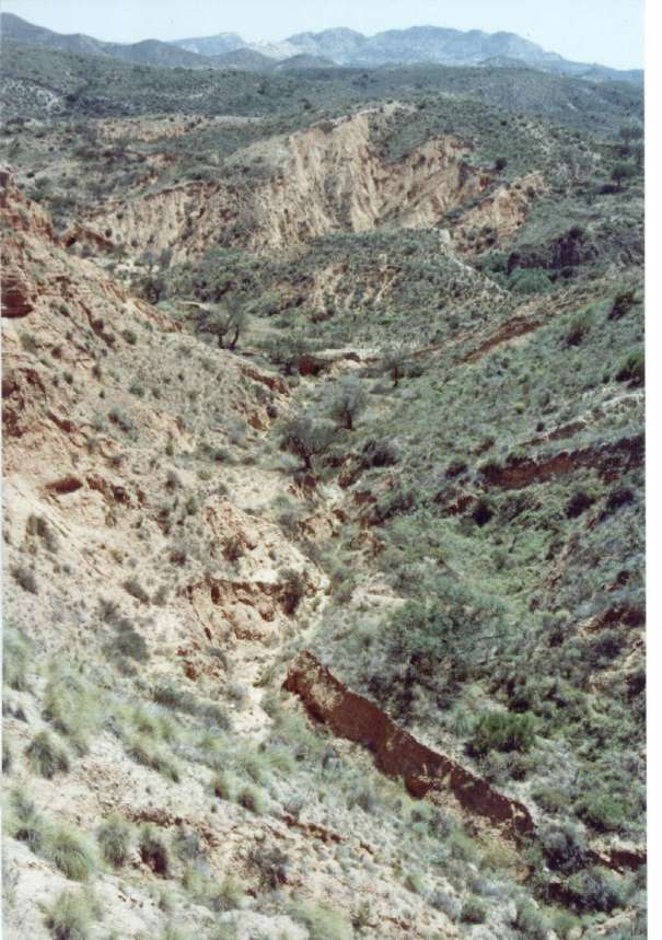
I spent a lot of time standing in terraced fields counting plants! I didn’t mind though as the scenery was absolutely mind-blowingly incredible. The rock and soil of the area is so easily washed away by torrential rain that that huge gulleys form in the sides of the hills, and sometimes enormous pipes form under the soil where material has been washed away under the surface. It was an utterly fascinating landscape to study in.
The first year went well, I gathered my field data, I analysed soil in the lab and I learnt to use a Unix computer (scary). However, the promised data didn’t arrive. It also didn’t arrive in 1998 by which time I was running into my third year and my funding was about to end. I was seriously depressed by this and decided that as the promised data was now two and a half years late, I would never finish my PhD, so I decided to look for a job.
I applied for and got a job. Of course life being what it is, in-between being offered the job and starting it, the data arrived in Feb 1999. My PhD supervisor, a very kind and supportive man called Alex suggested that I at least write up what I had already done to get an MPhil degree so that I and the university got some benefit from the work carried out. I decided to take six months off the PhD to concentrate on my new job, and then go back to writing up. But meanwhile, I managed to get hold of the remote sensing software for my home computer and I started to analyse the data and tie it in with my fieldwork.
The results were so interesting that I really wanted to research it properly which is how I ended up both working full time and finishing off my research and writing up my PhD. I had so much support from Alex, I couldn’t have done it without him.
2000 – 2002 was possibly the most stressful period in my entire life as during the two years it took me to finish the work on my PhD and write it up we also bought a house, got married and I was severely bullied by my manager. So all in all I am most proud of having had the fortitude and resilience to work through this absolutely fraught period of time and come out of it with my sanity (mostly) intact.
One highlight in this rather terrible period was our honeymoon which was a trip to SE Spain to help me finish off my fieldwork. We got the ferry from Plymouth to Santander in northern Spain and then drove our Ford Ka down through central Spain to Almeria. We had a wonderful time even if we did spend one week of the three out in the terraces counting plants (well I did this and Dave went to sleep in the sunshine!)
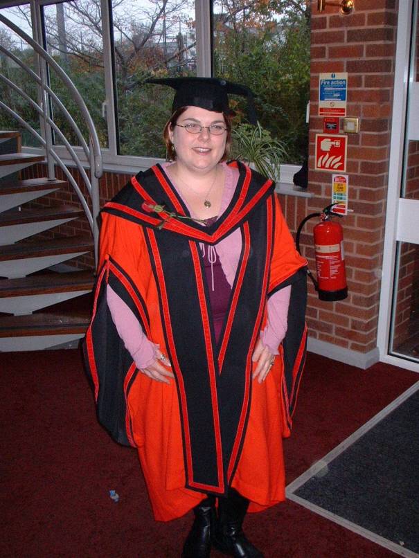
I graduated in November 2002 in Chester Cathedral. There were buglers and a choir and it was an amazing experience which I will never forget.
And whilst a thorough knowledge of the vegetation and geomorphology of a small part of SE Spain doesn’t actually sound particularly useful for someone who lives in the Lake District, I am able to apply an awful lot of what I learnt about how landscapes function and change to my job now. I’m so lucky to work doing something I’m interested in which is intellectually stimulating and related to my thesis.
Check out the other lovely bloggers writing about what makes them proud 🙂
Cathy: http://www.southernyacht.blogspot.co.uk/
Christy: http://www.sprintingwithscissors.blogspot.co.uk/
Daisy: http://daisysays.co.uk
Kate: https://wearingmywardrobein2016.wordpress.com
Kath: https://fatheffalump.wordpress.com
Leah: http://www.justmeleah.co.uk
Lee: http://www.pinkybellesshed.co.uk/
Lisa: http://www.kitandkoboodle75.blogspot.co.uk/
Mookie: http://www.mookieslife.com/
Nikki :http://www.nattynikki.com/
Perelandra: http://www.pamperandcurves.com/
Sarah: http://www.plussizeproud.co.uk
Steph: http://www.misskittenheel.com
Vicky: http://therandomnessoftwee.blogspot.co.uk
Yvonne: http://woosangwashere.blogspot.com
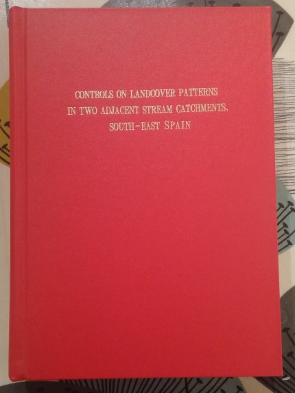
PS The Abstract for my thesis is copied below in case anyone is interested….
ABSTRACT
The Sorbas basin lies within the Betic Cordillera of south-east Spain. It is a recently uplifted sedimentary basin with readjustment of drainage systems still occurring, and hence intense erosion is found in places. This erosion, coupled with a semi-arid climate and a history of human impact has lead to a variably patchy vegetation cover throughout the catchment. This thesis examines controls on vegetation cover patchiness in a pair of adjacent catchments using a landscape ecology approach. These catchments display contrasting patterns of landcover and represent two stages in an erosion-stabilisation cycle driven by base level change on the Rio Aguas into which they both drain.
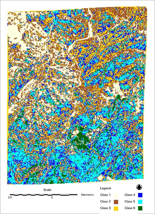
Cover and species type data were collected in the field along with soil samples. The vegetation analysis programs DECORANA and TWINSPAN were used to explore the cover and species data collected in the field. Results of the analyses were correlated with environmental variables to identify controls on distribution. Airborne Thematic Mapper (ATM) data were acquired from a NERC ARSF flight in 1996 along with aerial photographs of the study area. The ATM data were used to produce a clustered landcover image based upon the clustering of an NDVI image followed by interpretation of the six end groups using the cover data collected in the field. The aerial photography was used to produce a digital elevation model, and from this the environmental variables aspect, slope gradient and wetness were derived. The digital elevation model was also used in conjunction with the aerial photographs to produce an orthorectified image of the study area.
Geology was found to be the most significant control on cover type distribution, closely followed by geomorphology and soil chemistry. Species type distribution is also strongly controlled by geology with geomorphological history being almost as significant, and soil chemistry controlling the distribution at a fine scale. Slope gradient and aspect were not particularly associated with either cover or species distribution. The clustered landcover image, in which the six classes of cover ranged from very sparse to very densely vegetated, was analysed in conjunction with aspect, slope gradient and wetness to identify which of variable had the closest relationship with cover distribution. It was found that aspect had greatest association with cover, and wetness the least. However, all three show a statistically significantly relationship to cover class. The clustered landcover image was then used in conjunction with FRAGSTATS, a landscape metrics program, and a class buffering technique was used in order to quantify the landcover patterns in the two catchments. The quantification of pattern enabled an assessment of the relative controls of each of the environmental variables on the cover pattern in both catchments. Geology was found to be the most important control on the cover distribution, with geomorphological history and aspect important at a finer scale. Slope gradient, wetness and soil chemistry were not found to be very significant controlling factors.